Waterproof Chart Kit - South Shore Long Island #WPB0340-02
Model: WPB0340-02 Brand: Maptech
Waterproof Charts w/ Companion CD WPB0340 340: South Shore Long Island NY Harbor's Lower Bay to Montauk and Block Island. 25 chart pages, GPS waypoints, Lat. /Long. grids, pre-plotted courses, ramps, and 340 marine facilities. 12 x 17, scales 1:1,263,000 to 1:26,000. Product Overview These easy-to-use, compact chart books are ideal for Day-Sailors, Fishing Boats, and Trailer Boats. They measure 12 x 17 (24 x 17 when open) and are made of waterproof, tear-resistant synthetic paper that will withstand the elements. GPS Ready New features make Waterproof Chartbooks easy to use with your GPS. Most charts include one-minute lat./long. grids to make vessel positioning a breeze, and major navigation aids are identified with named GPS waypoints. Small and Large-Scale Charts Waterproof Chartbooks include small-scale, wide area charts as well as large-scale, detailed charts of harbors and approaches. « less
Product Specification
-
Universal Product Identifiers
Part Number: WPB0340-02
Related Products
-
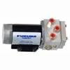
PUMPHRP17-12 1.7 Cubic Inch/Second Pump - 12V
-
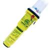
2714 Pathfinder Sart Survival Craft Radar Transponder
-
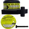
MT-403FFSVC Hydrostatic Release for MT-403FF & MT-403FG
-
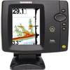
500 Series 596c - Fishfinder - included transducer : XNT-9-20-T - dual-beam
-
E12169 S1000 Pilot with Wireless Control
-
6ft 18AWG CL2 Premium 3-RCA Component Video Coaxial Cable
-
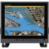
MU150HD 15 Inch Color LCD Marine Monitor
-
EC04230 Yellow Butt Connector 12-10
-
E55058 Seatalk HS Network Switch
-
1ft 24AWG Cat6 550mhz UTP Ethernet Bare Copper Network Cable - White
-
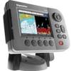
E62186 - A50D 5 Combo, Int GPS, w/o Charts
-
protective Cover Marine GPS