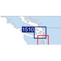
Waterproof Chart Kit - San Juan Islands #WPB1510-02
Model: WPB1510-02 Brand: Maptech
Waterproof Charts w/ Companion CD WPB1510 1510: San Juan Islands Whidbey Island and Bellingham to Boundary Pass. 23 pages of charts, 130 GPS waypoints, Lat. /Long. grids, courses, ramps, and marine facilities. Overview and detailed pass and harbor charts. 12 x 17, scales 1:200,000 to 1:20,000 Product Overview These easy-to-use, compact chart books are ideal for Day-Sailors, Fishing Boats, and Trailer Boats. They measure 12 x 17 (24 x 17 when open) and are made of waterproof, tear-resistant synthetic paper that will withstand the elements. GPS Ready New features make Waterproof Chartbooks easy to use with your GPS. Most charts include one-minute lat./long. grids to make vessel positioning a breeze, and major navigation aids are identified with named GPS waypoints. Small and Large-Scale Charts Waterproof Chartbooks include small-scale, wide area charts as well as large-scale, detailed charts of ha « less
Product Specification
-
Universal Product Identifiers
Part Number: WPB1510-02
Related Products
-
50 ft VGA cable 15 pin HD D-Sub (HD-15) - male - PC
-
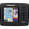
HDS-5 Gen2 Nautic Insight w/o Transducer CW42971
-
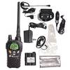
Nautico 3 VHF Marine Emergency Radio Rechargeable
-
USA 010-11001-50 Topo US 2008 landmarine Map
-
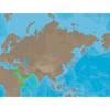
ME-C202 Furuno FP Format - Red Sea - Arabian Sea
-
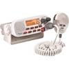
MR45-D White Fixed Mount Class D Submersible VHF Radio 40518
-
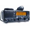
America Inc. M710-21 SSB
-
50ft 24AWG Cat6 550mhz UTP Ethernet Bare Copper Network Cable - Red
-
332037 LED Starboard Side Mount White
-
100ft Premium Optical Toslink Cable w/ Metal Fancy Connector
-
Light Bar with Perko 1197 Anchor Light LTB100 (LTB-R + LTBP-1197)
-
700 Series 798ci SI Combo NVB - Marine Chartplotter - 5" color - 640 x 640