Waterproof Chart Kit - San Juan Islands
Model: Brand: Maptech
Waterproof Charts w/ Companion CD WPB1510 1510: San Juan Islands Whidbey Island and Bellingham to Boundary Pass. 23 pages of charts, 130 GPS waypoints, Lat. /Long. grids, courses, ramps, and marine facilities. Overview and detailed pass and harbor charts. 12" x 17", scales 1:200,000 to 1:20,000 Product Overview These easy-to-use, compact chart books are ideal for Day-Sailors, Fishing Boats, and Trailer Boats. GPS Ready New features make Waterproof Chartbooks easy to use with your GPS. Most charts include one-minute lat./long. grids to make vessel positioning a breeze, and major navigation aids are identified with named GPS waypoints. Small and Large-Scale Charts Waterproof Chartbooks include small-scale, wide area charts as well as large-scale, detailed charts of harbors and approaches. The Chart Page Index (on the front cover) and "Go-To" page numbers make it simple to quickly find the chart you want. Pre-Plotted Courses Maptech's navigation editors add magnetic courses between major navigation aids with distances in nautical miles. Chartbooks are also designed to help you do the calculations yourself. Each page includes a Compass Rose with annual increase in variation and complete scale information. Waterproof and Tear-Resistant Waterproof Chartbooks have a durable plastic binding and are printed on high-quality, waterproof, tear-resistant paper. Chart images are crisp and easy-to-read. They can handle just about any conditions you'll find on the water - yes, that includes a spilled drink or two! "Paper and Digital Charts Together!" - A Maptech Exclusive It's all here...digital charts and the software tools to use them. And the great thing is the digital charts are the same identical charts with GPS waypoints and course lines - just like in the Chartbooks. Click to Create Routes Chartbook Companion CDs include "Offshore Navigator Lite" navigation software. Click your mouse to put a waypoint on a chart. Click again, and you're creating a route. It's that easy. Distances, bearings and GPS positions are calculated and displayed instantly « less
Product Specification
-
Universal Product Identifiers
Part Number: 35272
Related Products
-
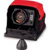
LX-5 Dual Beam True Color Sonar Flasher System
-
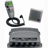
010-00756-01 VHF 300i Marine Radio
-
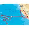
MSD/644P+ Platinum Plus Hawaii, California South to Baja on
-
6/3 50 Amp, 125 Volt Cable, 250' Spool, Yellow 14180
-
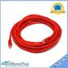
20ft 24AWG Cat6 550mhz UTP Ethernet Bare Copper Network Cable - Red
-
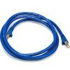
5ft 24AWG Cat6a 500mhz Stp Ethernet Bare Copper Network Cable - Blue
-
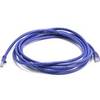
10ft 24AWG Cat5e 350MHz UTP Bare Copper Ethernet Network Cable - Purple
-
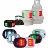
Series 32 LED Navigation Lights White Housing
-
CPA-120 Cell Phone to Marine Antenna Adapter Cable
-
PDRT-WBL Trolling Mnt w/Remote Temp Blue Connector
-
120-37 Yamaha (Late model) engine I/F
-
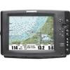
1100 Series 1155c - Marine Chartplotter - 10.4" color - 800 x 600