Waterproof Chart Kit - Puget Sound #WPB1520-02
Model: WPB1520-02 Brand: Maptech
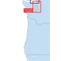
Waterproof Charts w/ Companion CD WPB1520 1520: Puget Sound Covers the entire sound from Olympia to Admiralty Inlet, including Lake Washington. 25 pages of charts, 150 GPS waypoints, Lat. /Long. grids, courses, ramps, and 180 marine facilities. Overview and detailed charts. 12 x 17, scales 1:225,000 to 1:13,000. Product Overview These easy-to-use, compact chart books are ideal for Day-Sailors, Fishing Boats, and Trailer Boats. They measure 12 x 17 (24 x 17 when open) and are made of waterproof, tear-resistant synthetic paper that will withstand the elements. GPS Ready New features make Waterproof Chartbooks easy to use with your GPS. Most charts include one-minute lat./long. grids to make vessel positioning a breeze, and major navigation aids are identified with named GPS waypoints. Small and Large-Scale Charts Waterproof Chartbooks include small-scale, wide area charts as well as large-scale, d « less
Product Specification
-
Universal Product Identifiers
Part Number: WPB1520-02
Related Products
-
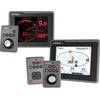
E22116 ST70 Plus Instrument Keypad
-
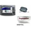
Package(C120W, DSM300G Sounder, 4KW 18 Inch Digital Radome & Radar Cable)
-
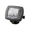
Fishfinder 140 - Fishfinder - included transducer - dual-beam
-
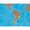
SA-C003 C-Card Format - Rio de Janeiro - Cape Horn
-
Active Pass,Porlier Pass/et Montague Harbour Chart
-
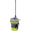
ACR Globalfix Pro 406 EPIRB Integral GPS - Category 2
-
15ft 16AWG Power Cord Cable w/ 3 Conductor PC Power Connector Socket (C13/5-15P) - Black
-
6ft DB-25(IEEE-1284) Male to Mini/Micro Centronic 36(hpcn36) Male Cable [IE]
-
35ft 22AWG 5-rca Component Video/audio Coaxial Cable (RG-59/U) - Black
-
2107 PowerBar 600 Ampere Cable Connector 8 x 3 8 16 Stud ter
-
Flush Mount Utility Light 401510-1 Threaded Mount 25-1527
-
VHF 200 25W VHF Radio 010-00755-00