The Sea Chart: The Illustrated History of Nautical Maps and Navigational Charts [Book]
The sea chart was one of the key tools by which ships of trade, transport and conquest navigated their course across the oceans. John Blake looks at the history and development of the chart and the related nautical map, in both scientific and aesthetic terms, as a means of safe and accurate seaborne navigation. This handsome work contains 150 color illustrations including the earliest charts of the Mediterranean made by early thirteenth-century Italian merchant adventurers, as well as eighteenth-century charts that became strategic naval and commercial requirements and led to Cook's voyages in the Pacific, the search for the Northwest Passage, and races to the Arctic and Antarctic. « less
Product Specification
-
Authors: John Blake, Lie LiePages: 160Format: paperbackPublication Date: September 1, 2009
-
Universal Product Identifiers
ISBN: 1591147824GTIN: 09781591147824
Related Products
-
AP5014 Autopilot with AP50, J50, Rudder Feedback RF300, HLD2000LD (Long Stroke, Dual Drive)
-
NMEA 2000 Micro Cable, 6M, Single Ended
-
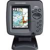
386ci Di Down Imaging GPS Fishfinder 409050-1 c46182
-
2.2KW 18 Radome 24 NM Range 5.2 Deg Beam 182x
-
Navigation Light All Round Pedestal Mount, White Lens
-
6.6 ft DVI cable - dual link 24 pin digital DVI - male - PC
-
6in Plain Bronze Door Hook
-
200-015 - 360 Degree Green - LED Navigation Light
-
Drain Plug Black
-
2710 Cover Connector Dual Bus 2702
-
LTD A1530S 15 to 30 Amp 125v/125v Straight Adapter
-
386ci GPS Fishfinder 409030-1 c46181