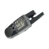
RINO 130 - Hiking GPS receiver / two-way radio - Monochrome - 160 x 160
Model: 130 Brand: Garmin
The Rino 130 is the most feature-rich unit in the Rino family, with a built-in electronic compass, barometric sensor, weather receiver for seven NOAA weather channels, and 24 MBs of internal memory. This handheld radio has a built-in electronic compass to give a heading while the user is standing still, and a barometric altimeter to provide extremely accurate elevation and pressure information, which will assist users in identifying weather data. The Rino 130 provides two-way radio communication with a transmission range of up to two miles using FRS channels and up to five miles with GMRS. The integration of two-way radio and GPS enables users to transmit their position with a simple button press, allowing others to navigate to their position. The Rino 130 also has a polling feature, which allows a user to manually request GPS location information from other Rino units. « less
Product Specification
-
General
Product Type: GPS receiver / two-way radioRecommended Use: HikingPreloaded Maps: North America, South AmericaReceiver: 12 channelInterface: Serial, NMEA 0183, RTCM SC-104 DGPSIncluded Software: Garmin Marine Point Database (Americas), Garmin Americas Highway BasemapCompatible Software: MapSource BlueChart, MapSource US TOPO 24K, MapSource MetroGuide, MapSource Recreational Lakes, MapSource US TOPOGrids: UTM, MGRS, Lat/Lon, UPS, Loran TDs, MaidenheadSBAS: WAASDGPS: DGPS readyAntenna: ExternalAccuracy: Position - 49 ft Velocity - 0.16 ft/sec Position - 10 ft - 16 ft ( with DGPS ) Velocity - 0.16 ft/sec ( with DGPS ) Position - 10 ft ( with WAAS ) Velocity - 0.16 ft/sec ( with WAAS )Update Rate: 1/secondInternal Memory: 24 MB flashFirst Seen On Google Shopping: July 2004 -
Display
Type: LCD - monochromeResolution: 160 x 160Display Illumination: Yes -
Acquisition Times
Warm: 15 secCold: 45 sec -
Navigation
Waypoints: 500Tracks: 20Tracklog Points: 10000Routes: 20Trip Computer: Average speed, maximum speed, trip timer, trip distance, sunrise/sunset times, sun/moon positions -
Connections
Interfaces: Serial - RS-232 -
Battery
Type: AA typeRequired Qty: 3Run Time (Up To): 28 hours -
Miscellaneous
Protection: WaterproofWaterproof Standard: IPX7Included Accessories: PC cable, wrist strap, belt clip -
Dimensions & Weight
Width: 2.3 inDepth: 1.6 inHeight: 4.5 inWeight: 8.3 oz -
Environmental Parameters
Min Operating Temperature: -4 °FMax Operating Temperature: 158 °F -
Universal Product Identifiers
Part Numbers: 010-00270-03, 010-00270-23, 130GTIN: 00753759031978, 00753759042202, 00753759071028
Related Products
-
Olympic Coast National Marine Sanctuary Habitat Mapping: Survey Report and Classification of Side Scan Sonar Data from Surveys Hmpr-114-2004-02 and Hmpr-116-2005-01 [Book]
-
CL-AISR AIS Radar
-
Package(e7D with Sonar & aus, NZ, S. America, Asia Chart, 4KW 24 Inch Digital Radome & Radar Cable)
-
53518900 HDS-7 Gen2 Insight USA 50/200kHz
-
Cat6a Ethernet Cable | 5ft | Gray | Network | 10 Gigabit
-
10070001 - 1420 System w/ Morse Cable Drive
-
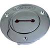
Deck Plates, Fills for Pipe, 3", Unmarked, Bronze
-
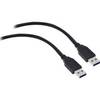
USB 3.0 Cable | Black | 3ft | Type A to Type A | Male/Male
-
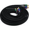
12ft 18AWG CL2 Premium 3-RCA Component Video Coaxial Cable
-
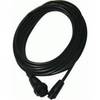
Opc1540 Command Mic III Cable 10617439
-
18-8078 Suzuki Male Fuel Connector
-
355 2 Conductor Start Interlock Cable