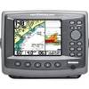
Radar 5008 Package with GMR24HD 4KW Radome & GSD22 Sounder
Model: GMR24HD Brand: Garmin
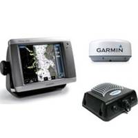
The package includes Garmin GPS Chartplotter Garmin GPS Antenna Garmin Radome Garmin Sounder GSD22 Garmin Power, GPS, and Radar cables Manuals This flagship marine navigator is missing just one thing buttons. The GPSMAP 5008 features an unprecedented touchscreen interface, along with a satellite-enhanced worldwide basemap and an 8.4" screen that makes navigation as easy as pointing your finger. By connecting to the Garmin Marine Network, you can add sonar, radar and weather. For even more advanced features, you can add the optional BlueChart g2 Vision card. View Detailed Graphics and Video The GPSMAP 5008 features a worldwide basemap with high-quality satellite images in place of more traditional maps. For even more detail, you can add maps easily with the SD card slot without having to connect to a computer. To keep tabs on your engine room or other area of your boat, you can connect a live video feed with the 5008's video input/output options. Add Extras with BlueChart g2 Vision With the optional BlueChart g2 Vision SD card, you can add a whole new dimension of exceptional features to your chartplotter. 3D mariner's eye view or fish eye view provides you with a 3-dimensionsl perspective of map information, both above the waterline and below it. High-resolution satellite images and aerial photographs help you orient yourself in unfamiliar areas. Auto Guidance technology searches through all relevant charts to create a route you can actually follow one that avoids obstacles, shallow water, buoys and other obstructions. Connect to the Garmin Marine Network The 5008 connects easily to the high-speed Garmin Marine Network, so you can interface with additional MFDs and add remote sensors. Once connected, you can share information between the 5008 and other chartplotters on your boat. You can also add high-powered radar, sonar, and XM satellite weather and radio to your system. D, Jan, 2008 | Download NMEA 2000 Network Fundamentals, Rev. A, Jan, 2008 | Download Owner's Manual, Rev. D, Jan, 2008 | Download Quick Reference Guide, Rev. B, Jan, 2008 | Download EL Quick Reference Guide (Greek), Rev. B, Jan, 2008 | Download RU Quick Reference Guide (Russian), Rev. B, Jan, 2008 | Download Some downloads may require Adobe Acrobat Reader. Download a free copy here . « less
Product Specification
-
Universal Product Identifiers
Part Number: gmrpack20
Related Products
-
AP2802 Autopilot AP28,AC42,RC42,RF300, No Drive
-
HDS-7 - Marine Chartplotter - 6.4" color - 640 x 480
-
000-10421-001 Broadband 4G Radar w/20m Cable
-
FBRS 2775 Battery Serive Includes 1096 Batt Parts Labor
-
ResQLink PLB with Free Floating Pouch #2880/9521
-
Bronze Seacock, 3/4 Inch Adapter, Straight 0835005PLB
-
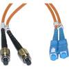
10gb Fiber Optic Cable, LC/LC, Multi Mode, Duplex - 1 Meter
-
Cblwhl Fcsc-11104 FC SC Multimode Duplex Fiber Optic Cable 62 5 125 4
-
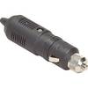
Parts Express Marine Grade Locking Cigarette Lighter Plug 12 VDC
-
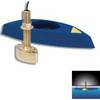
B45-DT-10N 600W Thru-Hull Transducer Northstar 10-Pin Connector
-
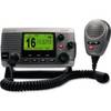
34170 Vhf-200 VHF Radio W/class-d DSC
-
Matrix 97 Combo - Marine Chartplotter - 5.6" color - 320 x 240