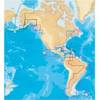
Paper Chart Kit Book REGION03 New York to Nantucket
Model: REGION03 Brand: Maptech
Completely updated. Coastal and offshore coverage. Full-color charts, GPS waypoints, courses and distances, Yeoman points, and color aerial photos. Save hundreds of dollars on charts. 22 X 17, 90 chart pages. Product Overview New features make ChartKits easy to use with your GPS. Most charts include one-minute lat./long. grids to make vessel positioning a breeze, and major navigation aids are identified with named GPS waypoints. GPS Ready New features make ChartKits easy to use with your GPS. Most charts include one-minute lat./long. grids to make vessel positioning a breeze, and major navigation aids are identified with named GPS waypoints. Small and Large Scale Charts ChartKits include small-scale, wide area charts as well as large-scale, detailed charts of harbors and approaches. « less
Product Specification
-
Universal Product Identifiers
Part Number: PAPREGION03
Related Products
-
Musician's Gear Bag Black
-
A57D Chartplotter Fishfinder No Preloaded Charts 10257368
-
MDS-10-4 Radar Sensor 4KW 4 Array 1/8-48 NM
-
A67 5.7 Multifunction Radar Pack WE70077E92130A55077dA6236
-
37673 Platinum Plus South Alaska on SD Micro SD
-
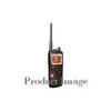
MHS125 Marine Handheld Radio
-
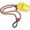
Buztronics, Inc. 1043420 Light-Saver Marine Distress LED Strobe Light
-
Navigational Systems and Simulators: Marine Navigation and Safety of Sea Transportation [Book]
-
70M Double Starboard Nav Light
-
LTD 50F1 50 Amp 125 Volt Female Connector
-
SS264W - 50kHz - 20 Deg - Navico Blue Connector
-
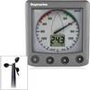
26235 ST60 Plus Wind System with Rotavecta Wind Transducer