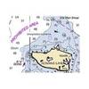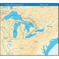
NT+ Wide Map, Ohio River: Cairo to Pittsburg NA-C039
Model: NA-C039 Brand: C-Map
C-MAP has set the standard for electronic charts with five consecutive NMEA awards for "Best Electronic Cartography". Built on the incredible success of C-MAP NT+, NT+ Wide combines a generation of chartplotters with efficient performance plus real-time accuracy and detail. Now you will be able to see slip detail as well as the locations for onshore facilities. « less
Product Specification
-
Universal Product Identifiers
Part Number: NA-C039GTIN: 00686074003989
Related Products
-
SE200B Sonar engine (u1-200b-00c)
-
GMR 604 XHD Radar - 4 ft. 6KW Pedestal Array
-
Paper Charts ChartKit Book w/ Companion CD - Pacific Northwest 32507
-
Puget Sound (Small Craft) Chart
-
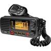
Ite-unnum415bk-ptrind1 Um415Oceanus D Marine Radio
-
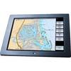
GB40 15 Inch Glass Bridge Navigation System (Requires GPS Antenna)
-
30ft 24AWG Cat6 550mhz UTP Ethernet Bare Copper Network Cable - White
-
LD 5969 Mini DisplayPort to HDMI Video Adapter Cable (White)
-
Regatta 1 25W VHF Radio - White CW32225
-
GPSMAP 78 - Marine, hiking GPS receiver - 2.6" color - 160 x 240
-
000-10494-001 Elite-4 DSi Combo Base Transducer
-
2842 Globalfix Pro 406 EPIRB Integral GPS - Category 1