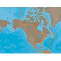
NAM033SD Mega Wide Atlantic CST & Carib
Model: NAM033SD Brand: C-Map
NA-M033 => Atlantic Coast, Gulf of Mexico and CaribbeanCoverage includes most of the eastern coastline of North America. Canadian coverage starts in Arctic Canada and continues east to Hudson Bay, Ungava Bay and Frobisher Bay before continuing south down the Labrador coast to Newfoundland, the Gulf of St. Lawrence and Nova Scotia. Lawrence River is covered down to Montreal. US coverage picks up at Passamaquoddy Bay and heads south down the Atlantic coast, picking up all of Chesapeake Bay, and continuing down to Key West, FL before turning into the Gulf of Mexico. The Gulf of Mexico, from Key West, FL to Brownsville, TX is covered in its entirety. Latin America is covered from the Mexico/US border over around the Yucatan Peninsula along the coasts of Belize, Honduras, Nicaragua, Costa Rica and through the Panama Canal before turning north up the Pacific coastline to Salina Cruz, Mexico. All the islands of the Caribbean are covered, from the Bahamas over to « less
Product Specification
-
Universal Product Identifiers
Part Numbers: 30153, NA-M033SD, NA-M033SDCARDGTIN: 00686074002876
Related Products
-
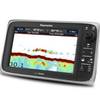
E97 Multifunction 9" Display with Sonar - No Charts E70022
-
C97 Multifunction 9" Display with Sonar - US Inland Charts T70027 c44325
-
WPC034 Sandy Hook NJ to AC NJ Ed 3
-
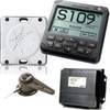
AP2401 Autopilot System AP24 AC12 RC42 RF300 No Drive
-
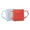
Cal June/Jim-Buoy 101W White Vinyl Buoyant Boat Throw Cushions USCG Approved Type IV-
-
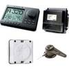
AP2804 Autopilot System AP28,AC42,RC42,RF300,RPU160
-
Marinenav Leviathan Marine Navigation PC Computer LEV-017R-AMD
-
3ft 30AWG High Speed HDMI Cable - HDMI Connector to HDMI Mini Connector - Black
-
OK105 18inch SATA Data and Power Combo Cable - UV Blue
-
100ft 24AWG Cat6 550mhz UTP Ethernet Bare Copper Network Cable - Red
-
Air Breeze 1-ARBM-15-12 Marine Wind Generator 12VDC
-
Weather cap - Cable end cap