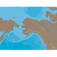
NA-C701 Furuno FP Format Olympia Wa - Port Mcneill BC
Model: NA-C701 Brand: C-Map
With are Electronic Sharts C-Maps we have: Olympia, Washington to Port Mcneill, British Columbia. Nannose to Victoria to Cape Scott Texada Island to Caamano Sound Cape Caution to Portland Canal Banks Island, British Columbia to Sumner Strait, Alaska Dixon Entrance to Icy Bay Gulf of Alaska Western Alaska NA-C701 Olympia, WA To Port McNeill, BC NT+ Cartography NT+ electronic charts feature much wider coverage areas at substantially lower prices. « less
Product Specification
-
Universal Product Identifiers
Part Numbers: 20179, NA-C701FURUNOFP
Related Products
-
50 ft VGA cable 15 pin HD D-Sub (HD-15) - male - PC
-
Dd15 Mechanical Pump Drive 21119896
-
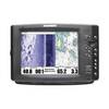
1100 Series 1197c SI Combo CHO - Marine Chartplotter - 10.4" color - 800 x 600
-
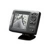
Mark 5x Portable - Fishfinder - included transducer : Skimmer
-
PC Planner 2MB NT+ & Max Navman Standard Sitex Simrad
-
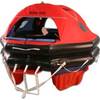
MD3-6H Life Raft 6 Person Hard Canister
-
30ft 24AWG Cat6 550mhz UTP Ethernet Bare Copper Network Cable - Yellow
-
4164 35ft 24AWG CL2 Flat Standard HDMI Cable - Black
-
Ram 1.5" Connector
-
1852069 Adapter Cable Lowrance 6 Pin
-
105SPP Pigtail Adapter 15A Straight Blade to 30A
-
Tram 1655 8-ft Marine GPS Antenna