Mobile Bay to Pensacola Offshore Fishing - Waterproof Charts
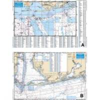
Designed for recreational boaters, fishermen and divers. Waterproof Charts are beautifully printed on synthetic paper. For use on deck in any weather rain or spray! Accurate, used by Coast Guard and Navy, simple to use with GPS. Foldable and easy to hold and store Waterproof Charts are so tear resistant you can't ruin them. Printed on both sides so they save you money! Offshore coverage from Dauphin Island, Alabama to Pensacola Beach Florida out 30 plus miles. This chart is a compilation of 3 NOAA charts # 11360, 11376 and 11382. This chart goes up into MOBILE BAY over 21 miles, and offshore over 30 miles. From Daupin Island the chart goes over 55 miles to the South. The chart has over 550 plotted and indexed GPS waypoints for wrecks, reefballs, ledges and artificial reefs, fishing and diving locations. The really unique feature to this Offshore Fishing Chart is that it is LARGE PRINT!!! Meaning it is much easier to see the coordinates of your favorite fishing destination. No one has a chart like this. If you want ORANGE BEACH , Alabama, you want this chart. « less
Product Specification
-
Universal Product Identifiers
Part Number: 94F
Related Products
-
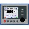
Admiral P2 Color Display, SSRC1 Rate Gyro Compass, No Feedback
-
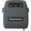
E32122 SR6 Sirius Satellite Weather Receiver with Network Sw
-
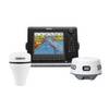
NSE8 Navigation Package NSE-8, GS-15 GPS Antenna and 3G Radar
-
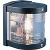
Series 25 Classic Starboard Navigation Light
-
E55050 5M SeaTalk hs Network Cable
-
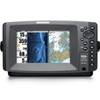
898CSI Combo w/ External Antenna 36982
-
1.5ft Premier Series XLR Female to 1/4inch TRS Male 16AWG
-
Ethernet Category 6 Enhanced RJ45 Network Patch Cable - 50' Black.
-
25ft Premier Series XLR Male to 1/4inch TRS Male 16AWG Cable (Gold Plated)
-
SmartPlug BF30 30 Amp Marine Shore Power Connector
-
1852068 MKR-US2-8 Hum 7 Pin Connector
-
GPS 152H - Marine GPS receiver - 4" monochrome - 100 x 160