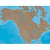
Max EN-M082 W28 River Danube-MAX
Model: EN-M082 Brand: C-Map
Product Specification
-
Universal Product Identifiers
Part Number: EN-M082
Related Products
-
AS-RSL Matrix to Smartcast Sonar Link wasrsl
-
Max Lakes Canada C-Card NA-M048
-
010-00757-00 VHF 300 AIS Marine Radio
-
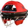
MD3-6H Life Raft 6 Person Hard Canister
-
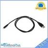
USB 2.0 A Male to Micro-B Male Cable 3 ft.
-
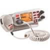
Mr F75-D Fixed Mount Class D VHF Radio - White 40521
-
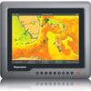
G120 12" Inverted Marine Display 38327
-
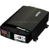
Br Wholesale RV & Marine 806-1206 Prowatt Sw 600 Inverter
-
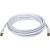
10ft RG6 (18AWG) 75OHM, Quad Shield, CL2 Coaxial Cable with F Type Connector - White
-
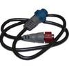
127-05 NAC-FRD2FBL Fem. Red to Fem
-
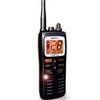
MHS125 Floating HH VHF
-
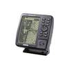
GPSMAP 182 - Marine GPS receiver - 5.5" monochrome - 360 x 240