MapSource BlueChart - Southeast Florida - Maps
Model: Brand: Garmin
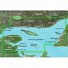
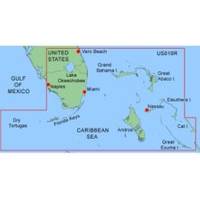
MapSource BlueChart is Garmin's exclusive marine cartography and was developed to provide you with mapping flexibility and options you've never had before. This line of cartography products is designed to provide interactive viewing of detailed nautical chart data, thereby providing navigators with innovative object-oriented cartography. These detailed electronic nautical charts look just like paper charts when displayed on your Garmin chartplotter. Features include shading between depth contours, spot soundings, navaids, port plans, wrecks, obstructions, inter-tidal zones, and more. BlueChart offers much larger coverage areas for half the price. MapSource BlueChart Southeast Florida covers Vero Beach south to include Lake Okeechobee, Florida Keys, Dry Tortugas, and covering the west coast of Florida north to Naples. Also covered all the Bahamas, Andros Island, Eleuthera Island, Cat Island, Great Exuma Island, Little Exuma Island, and Hog Cay. It features data from explorer charts for the Bahamas. « less
Product Specification
-
General
Product Type: MapsDistribution Media: microSD Memory CardFirst Seen On Google Shopping: January 2006 -
Compatibility Information
Designed For: Garmin eTrex Legend Cx, Vista Cx Garmin GPSMAP 60CSx, 60Cx, 76CSx, 76Cx -
Universal Product Identifiers
Part Numbers: 010-C0345-00, Southeast FloridaGTIN: 00753759055745
Related Products
-
Canadian Charts - N amp; O, Otter passage-bonilla Island Canadian
-
BlueChart g2 Vision - Les Mechins to St. George's Bay - Maps
-
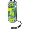
SARLink 406 MHz GPS Personal Locator Beacon 2883
-
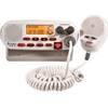
Mr F45-D Marine Digital Selective Calling Technology Fixed Mount VHF Radio - White
-
2273 ACR Rapidditch,#153 Express Bag - Bouyant Abandon Ship Survival G
-
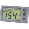
E22044 ST-40 Depth w/Thru Hull Transducer
-
30ft 24AWG Cat6 550mhz UTP Ethernet Bare Copper Network Cable - Yellow
-
Cat6a Ethernet Cable | 1ft | Orange | Network | 10 Gigabit
-
Th-1202-B Thru Hull 1-1/8" White 1-1/4" Hull
-
50M1 50 Amp - 125VAC Male Plug
-
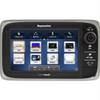
E62354 E7 7" Multifunction Display w/Internal GPS - No
-
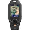
ONIX400 - Hiking GPS receiver - 3.5" color - 320 x 240