MapSource BlueChart - Red Sea - Maps
Model: Brand: Garmin
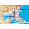
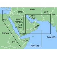
MapSource BlueChart is Garmin's exclusive marine cartography and was developed to provide you with mapping flexibility and options you've never had before. This line of cartography products is designed to provide interactive viewing of detailed nautical chart data, thereby providing navigators with innovative object-oriented cartography. These detailed electronic nautical charts look just like paper charts when displayed on your Garmin chartplotter. Features include shading between depth contours, spot soundings, navaids, port plans, wrecks, obstructions, inter-tidal zones, and more. BlueChart offers much larger coverage areas for half the price. MapSource BlueChart Red Sea covers of the Red Sea and Gulf of Aden in their entirety, as well as the Indian Ocean including portions of the coasts of Somalia and Oman. Also includes coverage of the Mediterranean Sea from Beirut, Leb. to Alexandria Egy., including the Suez Canal and Gulf of Aqaba. Included in this overall general coverage are numerous detailed charts covering areas such as Jiddah, Sau., Djibouti, Dji., and Aden, Yem. « less
Product Specification
-
General
Product Type: MapsDistribution Media: microSD Memory CardFirst Seen On Google Shopping: January 2006 -
Compatibility Information
Designed For: Garmin eTrex Legend Cx, Vista Cx Garmin GPSMAP 60CSx, 60Cx, 76CSx, 76Cx -
Universal Product Identifiers
Part Numbers: 010-C0436-00, Red Sea
Related Products
-
Radar 4012 Package with GMR18 4KW Radome
-
CF/699P+ Platinum Plus North Bahamas on CF
-
1066 Replacement Lithium Battery for 2726 and 2727
-
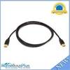
15ft HDMI to DVI Cable HDMI DVI Cord
-
6ft USB 2.0 A Male to A Male 28/24AWG Cable (Gold Plated)
-
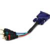
6025 6inch VGA to 3 RCA Component Video Cable (HD15 - 3-rca)
-
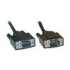
Serial extension cable - (DB-9) - M - (DB-9) - F - 50 ft - PC
-
EC5EF 5 Inch GPS Chartplotter Fishfinder Combo External Antenna
-
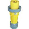
100HM1 120/250VAC - 100 Amp Male Plug
-
Trident Marine Hose 4" x 6" Fiberglass Splicer
-
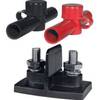
Power Post Dual 2 x 5/16 in. Studs
-
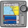
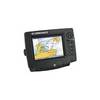
GlobalMap 6600C HD - Marine GPS receiver - 7" color - 640 x 480