MapSource BlueChart - Inland Rivers - Maps
Model: Brand: Garmin
MapSource BlueChart is Garmin's exclusive marine cartography and was developed to provide you with mapping flexibility and options you've never had before. This line of cartography products is designed to provide interactive viewing of detailed nautical chart data, thereby providing navigators with innovative object-oriented cartography. These detailed electronic nautical charts look just like paper charts when displayed on your Garmin chartplotter. Features include shading between depth contours, spot soundings, navaids, port plans, wrecks, obstructions, inter-tidal zones, and more. BlueChart offers much larger coverage areas for half the price. MapSource BlueChart Inland Rivers provides detailed main channel coverage of the major rivers of the interior of the United States. It includes the Ohio, Illinois and the Atchafalaya Rivers in their entirety, and the Mississippi River from its junction with the Illinois above St. Louis, MO to the Delta. It also includes the Tennessee River from Knoxville, TN to the Ohio; the Cumberland River from Celina, TN to the Ohio; and the Red River from Shreveport, LA to the Mississippi. It also provides general coverage of the Gulf of Mexico from Port Arthur, TX to Biloxi, MS; and the southern portion of Lake Michigan from Waukegan, IL to South Haven, MI. « less
Product Specification
-
General
Product Type: MapsDistribution Media: Garmin Data CardFirst Seen On Google Shopping: January 2006 -
Compatibility Information
Designed For: Garmin GPSMap 172C, 176, 176C, 178C, 178C Sounder, 182, 182C, 188 Sounder, 188C Sounder, 196, 2006, 2006C, 2010, 2010C, 2106C, 2110C, 2206C, 2210C, 232, 238 Sounder, 276C, 292C, 296, 298C, 3006C, 3010c, 3205C, 3206C, 3210C, 376C, 392C, 396C, 492C, 498C -
Universal Product Identifiers
Part Numbers: 010-C0487-00, Inland RiversGTIN: 00753759057282
Related Products
-
DRS12A - Digital Radar 12KW 72NM No-Ant 15m Cable
-
MDS-8 2KW 20 Inch Dome Radar Add-on with 10 Meter Cable wmds8
-
10 Inch Power Mount with Ltb Option #PMA-10FJ-7L
-
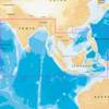
31XG/CF Indian Ocean and South China Sea Gold
-
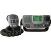
E43034 - Ray49 Class D Ultra Compact VHF
-
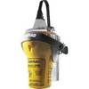
EPIRB Auto Release Cat I, No GPS EP50 Auto c30589
-
SP-80MS Mechanical Dash Drive w/ Built in Feedback
-
30 Amp 35' Cord Set - Yellow - 125V
-
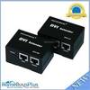
4064 DVI Extender Using Cat5e Cable Extending Upto 50 Meter, Supporting DDC & HDCP
-
Marina Micro LED Hub
-
Terk Sirmarine Satellite Radio Antenna
-
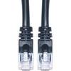
Cat6a Ethernet Cable | 15ft | Black | Network | 10 Gigabit