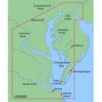
MapSource BlueChart - Chesapeake - Maps
Model: Brand: Garmin
MapSource BlueChart is Garmin's exclusive marine cartography and was developed to provide you with mapping flexibility and options you've never had before. This line of cartography products is designed to provide interactive viewing of detailed nautical chart data, thereby providing navigators with innovative object-oriented cartography. These detailed electronic nautical charts look just like paper charts when displayed on your Garmin chartplotter. Features include shading between depth contours, spot soundings, navaids, port plans, wrecks, obstructions, inter-tidal zones, and more. BlueChart offers much larger coverage areas for half the price. MapSource BlueChart Chesapeake provides detailed coverage of Baltimore through Virginia Beach, including the entire Chesapeake Bay, the C&D canal, Norfolk and Cape Charles. « less
Product Specification
-
General
Product Type: MapsDistribution Media: microSD Memory CardFirst Seen On Google Shopping: January 2006 -
Compatibility Information
Designed For: Garmin eTrex Legend Cx, Vista Cx Garmin GPSMAP 60CSx, 60Cx, 76CSx, 76Cx -
Universal Product Identifiers
Part Numbers: 010-C0341-00, 010-C0379-00, ChesapeakeGTIN: 00753759055707
Related Products
-
Video Sboatsmdvd DVD Boaters Guide to Twin
-
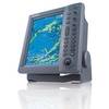
FR8062 12.1 Inch 6KW, 72 nm, 12.1 Color Display Radar 6' Open Array Antenna fr80626
-
A29 Imray Dominica Marine Nautical Chart
-
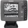
700 Series 718 - Fishfinder - included transducer : XNT-9-20-T - dual-beam
-
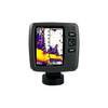
Fishfinder echo 550c - Fishfinder - included transducer - dual-beam
-
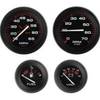
68362P Amega 4-Gauge Set (SpeedTachFuelVolt)
-
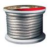
Raptor - BC4S100 - 4-Gauge Battery Cable - Silver 100' Spool
-
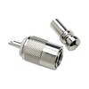
19811 PL259 with Adapter
-
Product Fcf0005000Gs Air Conditioner 115V FCF5000
-
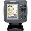
300 Series 383c Combo - Marine Chartplotter - 3" color - 240 x 320
-
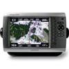
GPSMAP 4008 GPS Plotter with GPS Antenna 010-00591-00
-
GPS receiver remote control - Radio