MapSource BlueChart - Adriatic Sea, South Coast - Maps
Model: Brand: Garmin
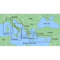
MapSource BlueChart is Garmin's exclusive marine cartography and was developed to provide you with mapping flexibility and options you've never had before. This line of cartography products is designed to provide interactive viewing of detailed nautical chart data, thereby providing navigators with innovative object-oriented cartography. These detailed electronic nautical charts look just like paper charts when displayed on your Garmin chartplotter. Features include shading between depth contours, spot soundings, navaids, port plans, wrecks, obstructions, inter-tidal zones, and more. BlueChart offers much larger coverage areas for half the price. MapSource BlueChart Adriatic Sea, South Coast provides detailed coverage of Italian coast from Porto Civitanova to extend south to Siracusa, Sicilia. From Split, Croatia to Killini, Greece. « less
Product Specification
-
General
Product Type: MapsDistribution Media: Garmin Data CardFirst Seen On Google Shopping: January 2006 -
Compatibility Information
Designed For: Garmin GPSMap 172C, 176, 176C, 178C, 178C Sounder, 182, 182C, 188 Sounder, 188C Sounder, 196, 2006, 2006C, 2010, 2010C, 2106C, 2110C, 2206C, 2210C, 232, 238 Sounder, 276C, 292C, 296, 298C, 3006C, 3010c, 3205C, 3206C, 3210C, 376C, 392C, 396C, 492C, 498C -
Universal Product Identifiers
Part Numbers: 010-C0107-00, Adriatic Sea, South Coast
Related Products
-
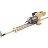
21113386 HLD-2000 MK2LS Long Split Hydraulic Linear Drive Unit
-
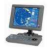
JMA-5106 Radar 72NM with 6KW with 4 Foot Open Array & 10 Inch Color LCD Display
-
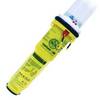
2714 Pathfinder Sart Survival Craft Radar Transponder
-
Marine World Chart of Nicolo de Canerio Januensis, Circa 1502: A Critical Study (1908) [Book]
-
BlueChart g2 Vision - Lake of the Woods / Rainy Lake - Maps
-
TS200-30 Temperature Probe f/SST-110 Thru-Hull
-
D10DX06T D10DX.06T Depth Sounder
-
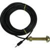
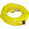
PH50 50 Foot Phone Cable Set (Yellow)
-
Mountable Head Cable Tie 8 Inch 40lbs, 100pcs/Pack - Black
-
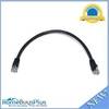
1ft 24AWG Cat6 550mhz UTP Ethernet Bare Copper Network Cable - Black
-
Flush Mount Scupper Adapters, Flush Mount Scupper Adapter White th
-
900 Series 957c Combo NVB CHO - Marine Chartplotter - 8" color - 800 x 480 - widescreen