Land navigation handbook: the Sierra Club guide to map, compass & GPS [Book]
Sooner or later any outdoor enthusiast will need more than trail markers for guidance. This best-selling manual--now thoroughly revised and updated--is designed for anyone who wants to chart a course in the wilderness: hiker, backpacker, snowshoer, skier, fisherman, or hunter. Step by step, it teaches the skills that enable you to answer the vital questions: Where am I now? Which way do I head to reach my destination? How far is it? And how long will it take me to get there? Starting with the basics of interpreting maps and orienting by compass, the book proceeds clearly through the more advanced mysteries of land navigation: measuring distances and estimating travel times; determining and adjusting for local declination around the globe; using an altimeter to add the dimension of height to one's position; and navigation by means of sun and stars. In updating the late W. S. Kals's text, coauthor Clyde Soles focuses on the latest developments in technology and equipment. Readers learn, for example, that through digital mapping software, one can order the exact area desired, at any scale, and print it on waterproof paper. Soles also surveys the popular new handheld GPS units and instructs in their use, and provides an overview of marine navigation for the growing sport of sea kayaking. Visuals include a full-color foldout topographic map for reference and practice, plus dozens of helpful drawings and photographs. Though much has changed, one thing certainly hasn't: the new edition of Land Navigation Handbook retains the solid information, spirit, and lively humor that made it a classic among outdoorspeople everywhere. « less
Product Specification
-
Authors: W. S. Kals, Clyde SolesPages: 239Format: paperbackPublication Date: September 1, 2005Key Terms: altimeter, contour lines, Milner Pass, Fall River Pass, GPS unit, sea kayaking, Polaris, nautical charts, map datum, position line, agonic line, magnetic North Pole, topographic maps, geocaching, Sigma Octantis, topo, waypoint, adventure races, kilometers, Global Positioning System
-
Universal Product Identifiers
ISBN: 1578051223GTIN: 09781578051229
Related Products
-
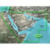
010-C0924-10 Bluechart G2 HAW005RThe Gulf & Red Sea Data Card
-
Plans - Saltspring Island Chart
-
701S-00616 ARH100 Automatic Hydostatic Release Housing
-
0.5ft 24AWG Cat5e 350MHz UTP Ethernet Bare Copper Network
-
15ft 24AWG CL2 High Speed HDMI Cable w/ Net Jacket - White
-
10ft 14AWG Power Cord Cable w/ 3 Conductor PC Power Connector Socket (C13/5-15P) - Black
-
50ft VGA to 3 RCA Component Video Cable (HD15 - 3-rca)
-
Marine -033420-10 Fuel CONN-FEMALE Mer (220050)
-
HBL64CM55 Y Adapter 2 50A 125V Cords - 50A 250V
-
B175-12-M Broadband CHIRP, No CONNECTOR, Depth & Temperature Thru-Hull Tilted
-
Terk Sirmarine Satellite Radio Antenna
-
000-10537-001 HDS-8 Gen2 Insight USA 83200khz Marine Electronics