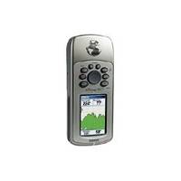
GPSMAP 76CS - Marine, hiking GPS receiver - 2.6" color - 160 x 240
Model: 76CS Brand: Garmin
All other marine handheld GPS units will pale when compared to the GPSMAP 76CS - literally. The latest color-display technology gives both units the brightest, sunlight-readable displays available. And with brand-new state-of-the-art receivers and powerful microprocessors, these units will give you a quick and steady fix. In addition, the GPSmap-76CS boasts a built-in electronic compass and barometric altimeter. The GPSMAP 76CS has the familiar GPS 76-family keypads and styling, with 115 MB of memory, an Americas Autoroute basemap, and a Marine Point database. Fast USB connectivity makes loading charts and maps quick and easy, while navigation instructions can be shared with repeaters, plotters, and autopilots using NMEA protocols through the dedicated serial port. It's waterproof and fully compatible with MapSource products like BlueChart, U.S. Topo 24K, and City Select (which provides detailed streets for turn-by-turn guidance). « less
Product Specification
-
General
Product Type: GPS receiverRecommended Use: Marine, hikingPreloaded Maps: South America, Canada, USA, Alaska, Central America, MexicoReceiver: 12 channelInterface: Serial, USB, NMEA 0183, RTCM SC-104 DGPSFunctions & Services: Electronic compass, elevation, MOB (Man Overboard), ascent/descent rateIncluded Software: MapSource Trip & Waypoint Manager, Garmin Marine Point Database (Americas), Garmin Americas Autoroute BasemapGrids: UTM, MGRS, Lat/Lon, User, Loran TDs, MaidenheadSBAS: WAASDGPS: DGPS readyAntenna: Built-inAccuracy: Position - 49 ft Position - 10 ft - 16 ft ( with DGPS ) Position - 10 ft ( with WAAS ) Velocity - 0.16 ft/secUpdate Rate: 1/secondInternal Memory: 115 MB flashFeatures: Barometric altimeterFirst Seen On Google Shopping: April 2004 -
Display
Type: LCD - colorDiagonal Size: 2.6"Resolution: 160 x 240Display Illumination: Yes -
Acquisition Times
Warm: 15 secCold: 45 sec -
Navigation
Waypoints: 1000Tracks: 20Tracklog Points: 10000Routes: 50Waypoints per route: 250Trip Computer: TracBack, average speed, maximum speed, trip timer, trip distance, sunrise/sunset times, sun/moon positions -
Connections
Interfaces: Serial - RS-232 Serial - USB Antenna - MCX -
Battery
Type: AA typeRequired Qty: 2Run Time (Up To): 30 hours -
Miscellaneous
Protection: WaterproofWaterproof Standard: IPX7Included Accessories: PC cable, lanyard -
Dimensions & Weight
Width: 2.4 inDepth: 1.3 inHeight: 6.1 inWeight: 5.4 oz -
Environmental Parameters
Min Operating Temperature: 5 °FMax Operating Temperature: 158 °F -
Universal Product Identifiers
Part Numbers: 010-00353-00, 010-00353-01, 76CS, GPSMAP76CSGTIN: 00753759045104
Related Products
-
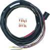
Boat (External) Wiring Harness Johnson/Evinrude OMC Red Plug New 473-9410 Instrument Cable Assembly
-
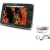
Package(e125 with aus, NZ, S. America, Asia Chart, 4KW 18 Inch Digital Radome & Radar Cable)
-
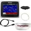
A67 5.7 Multifunction Radar Pack WE70077E92130A55077dA6236
-
Marine 004532161 Xenon Chart Light with 19" Flexible Arm, Black
-
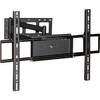
Adjustable Tilting/Swiveling Wall Mount Bracket for LCD LED
-
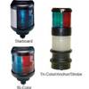
40 Stern Yellow Nav Light 12v/10w
-
5ft 24AWG Cat5e 350MHz UTP Bare Copper Ethernet Network Cable - Purple
-
Cat6a Ethernet Cable | 2ft | Yellow | Network | 10 Gigabit
-
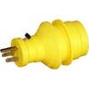
30 Amp to 15 Amp 125 Volt Hand Adapter Yellow
-
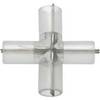
Corp mdl T Connector ILMDL-T
-
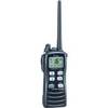
IC-M72 VHF Two-way radio
-
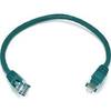
1ft 24AWG Cat5e 350MHz UTP Bare Copper Ethernet Network Cable - Green