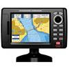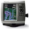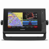
GPSMAP 742 Chartplotter
Model: 742 Chartplotter Brand: Garmin
SHOP BY CATEGORY
NEW PRODUCTSADVICE & HOW-TOSALEOUTLET
Marine Electronics >GPS & Radar >Multifunction Displays & Combos
GPSMAP 742 Chartplotter with U.S. BlueChart g2 and LakeVu HD Inland Charts
Enlarged view of picture, opens dialog
Product images carousel, showing slide 1 of 1
Video
GARMIN
GPSMAP 742 Chartplotter with U.S. BlueChart g2 and LakeVu HD Inland Charts
(0) 0 stars, 0 reviews, skips to reviews|Write The First Review
1Answered QuestionAsk A Question
$899.99
In stock online.
Only 3 in stock!
1
Add To Cart, Opens Dialog
Find in Store, opens dialog Add to My List
PLUS Product Protection Plan
Add extra coverage from the date of purchase beyond the manufacturer 19s warranty. View Details
2 Year 13 $109.49
1 Year 13 $79.44
Model # 17984600 | Mfg # 010-01738-01 | UPC # 753759168216
PRODUCT OVERVIEW
SPECS
ADVICE
REVIEWS
PRODUCT Q & A
Full chartplotting capability, wireless connectivity and much more in this 7 1D diagonal chartplotter.
Experience an advanced navigation solution with the compact GPSMAP® 742 chartplotter, with a sunlight-readable multi-touch touchscreen display. With built-in wireless connectivity for Garmin mobile apps and VIRB® action camera integration, you can stay connected to the newest media. Its 10Hz GPS/GLONASS receiver delivers smooth on-screen navigation.
This compact plotter offers full-network compatibility for the Garmin Marine Network, which allows support for sharing sonar, maps, user data, radar, IP cameras and Panoptix all-seeing sonar among multiple units. Plus, there 19s NMEA 2000 and NMEA 0183 support for autopilots, digital switching, weather, VHF, AIS and other sensors.
Preloaded premium mapping features both coastal and inland mapping, including both BlueChart® g2 HD charts for the US, Canada and Bahamas and LakeVü HD maps.
Product Specification
-
Screen Size: 7" diagonalScreen Resolution: 800 x 480Included Cartography: BlueChart® g2 HD coastal/LakeVu HD inlandReceiver Type: Internal 10Hz GPS/GLONASSDimensions: 8 13/16"W x 5 5/8"H x 2 1/8"D
Related Products
-
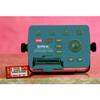
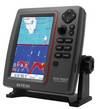
EXPLORER PLUS C-MAP MAX/NT+Charting System Control Unit
-
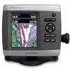
CP190i 5" ChartPlotter
-
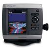
4" GPSMAP 441 Chartplotter
-
Chartplotter 431s with Dual-beam Transducer
-
GPSMAP 536 Chartplotter
-
a65 Touchscreen Multifunction Display, 5.7", Rest of the World Charts
-
GPSMAP 742 Chartplotter
-
GPSMAP 820
-
GPSMAP 8000
-
SVS-760C Digital Chartplotter
-
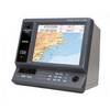
EC11 10.4 HD SVGA Color LCD
-
TRAWL PLOT 12SD 12.1" Color LCD 16 Ch. GPS/WAAS Charting System