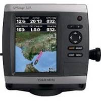
GPSMAP 521s - Marine Chartplotter - 5" color - 234 x 320
Model: 521s Brand: Garmin
The GPSMAP 521 is a compact chartplotter that features an ultra-bright 5" QVGA color display along with an improved high-speed digital design for increased map drawing and panning speeds. It's ready to go with a built-in, satellite-enhanced worldwide basemap and an easy-to-use interface designed to help you navigate the open waters with ease. Where applicable, the sounder version, GPSMAP 521s, comes with a powerful dual-frequency transducer that clearly illustrates depth contours, fish targets and structures whether you're fishing in fresh water or off the coast. The GPSMAP 521s is also NMEA 2000-certified for easy connectivity with sensors, instruments and future marine offerings. « less
Product Specification
-
General
Product Type: ChartplotterRecommended Use: MarineCard Reader: SD Memory CardInterface: NMEA 0183, NMEA 2000Included Software: Garmin Worldwide Marine BasemapCompatible Software: BlueChart g2 VisionAntenna: Built-inFeatures: Optional external GPS antenna connection, alarm, automatic routingFirst Seen On Google Shopping: November 2009 -
Display
Type: LCD - colorDiagonal Size: 5"Resolution: 234 x 320Features: Adjustable brightness -
Transducer
Transducer Presence: Included transducerTransducer Type: Dual-beam -
Navigation
Waypoints: 3000Tracks: 50Tracklog Points: 10000Routes: 100Trip Computer: Sun/moon positions -
Miscellaneous
Body Material: High-impact plasticProtection: WaterproofWaterproof Standard: IPX7Included Accessories: Protective cover, power/data cable, flush mount -
Dimensions & Weight
Width: 5.9 inDepth: 2.9 inHeight: 6.4 inWeight: 1.8 lbs -
Universal Product Identifiers
Part Numbers: 010-00760-01, 010-00760-02, 521sGTIN: 00753759095994
Related Products
-
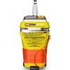
MT-403G AccuSat 406 Cat 2 EPIRB Intern GPS Non-Hazmat Withbracket
-
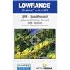
2-015 Outdoor US Southeast Chart for Endura Series
-
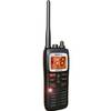
MHS125 Two Way VHF Marine Un MHS125 Mobile Equipmen
-
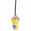
Smartfind 406 Category 2 #82-800-003A
-
000-10620-001 Triton Autopilot Computer - High Current
-
4KW 48mi Open Array Antenna Complet
-
2ft 24AWG Cat5e 350MHz UTP Bare Copper Ethernet Network Cable - Pink
-
15ft 32AWG Mini DisplayPort Cable - White
-
MU150HD 15 Inch Color LCD Marine Monitor
-
7ft 24AWG Cat6 500mhz Crossover Ethernet Bare Copper Network Cable - Gray
-
GlobalMap 3600C iGPS - Marine GPS receiver - 5" color - 480 x 480
-
Colormax Wide External 7 Inch Color LCD GPS / WAAS Charting sys