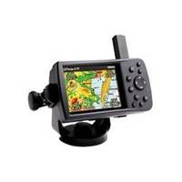
GPSMAP 478 - Marine GPS receiver - 3.8" color - 480 x 320
Model: 478 Brand: Garmin
Go from box to boat to dash with the portable and versatile GPSMAP 478. This combination color chartplotter and land navigator comes preloaded with U.S. marine charts utilizing elements of the latest BlueChart g2 technology, in addition to detailed street-level mapping. Optional weather and sonar capabilities combined with the ability to conveniently add plug-in data cards, let you easily add more maps and features - making this one incredible GPS navigator for land and sea. PRODUCT FEATURES: Accepts the latest (optional) BlueChart g2 data cards; Add optional GSD 21 for full-feature sonar capability; Add optional GXM 30 antenna for XM WX Satellite Weather; Provides tides and built-in celestial information; NMEA 0183 input and output; Removable quad helix antenna; Single knob tilt/swivel mount. « less
Product Specification
-
General
Product Type: GPS receiverRecommended Use: MarineReceiver: 12 channelInterface: USB, NMEA 0183Voice: Navigation instructionsIncluded Software: MapSource Trip & Waypoint Manager, MapSource City Navigator North America NTCompatible Software: MapSource BlueChart g2SBAS: WAASDGPS: DGPS readyAntenna: DetachableAccuracy: Position - 49 ft Position - 10 ft - 16 ft ( with DGPS ) Position - 10 ft ( with WAAS )Update Rate: 1/secondFeatures: Optional external GPS antenna connection, built-in speakerFirst Seen On Google Shopping: May 2006 -
Display
Type: TFT - colorDiagonal Size: 3.8"Resolution: 480 x 320Display Illumination: Yes -
Acquisition Times
Warm: 15 secCold: 45 sec -
Navigation
Waypoints: 3000Tracks: 15Tracklog Points: 10000Routes: 50 -
Battery
Type: Lithium ionRun Time (Up To): 15 hours -
Miscellaneous
Protection: WaterproofWaterproof Standard: IPX7Included Accessories: Protective cover, car power adapter, mounting bracket, AC power adapter, power/data cable, USB cable -
Dimensions & Weight
Width: 5.7 inDepth: 1.9 inHeight: 3.2 inWeight: 13.6 oz -
Manufacturer Warranty
Service & Support: 1 year warranty -
Environmental Parameters
Min Operating Temperature: 5 °FMax Operating Temperature: 140 °F -
Universal Product Identifiers
Part Numbers: 010-00543-00, 478GTIN: 00753759060329
Related Products
-
AP35-22 Autopilot with AP35, Rudder Feedback RF300, J300X and RPU-300 24V Drive Unit (for Hydraulic Steering) sap3522
-
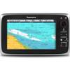
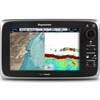
T70023 C97 Multifunction Display w/Sonar - European Charts
-
Package(e95 with USA Coastal Chart, 4KW 18 Inch Digital Radome & Radar Cable)
-
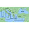
MapSource BlueChart - Adriatic Sea, North Coast - Maps
-
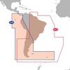
Max Electronic Chart - South America - Costa Rica to Chile & The Falklands, Wide Coverage SA-M500
-
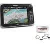
E70021 E95 Multifunction Display - No Preloaded Charts
-
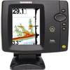
500 Series 596c - Fishfinder - included transducer : XNT-9-20-T - dual-beam
-
Fishfinder 400C - Fishfinder - included transducer - dual-beam
-
Hook & Loop Fastening Cable Ties 6inch, 10pcs/Pack - Blue
-
da-da572 Mini-UHF Male to TNC Female Adapter
-
36 Inch Aft Power Mount Simrad & Nobeltec PMA-36N-8L with Light Bar Option (PMA-367-M1 + ADA-R1)
-
Floodlight Kit for 1- Diameter Light Bars - Includes LED Light & Hardware PM-114LT-LED