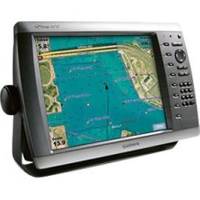
GPSMAP 4212 - Marine Chartplotter - 12.1" color - 1024 x 768
Model: 4212 Brand: Garmin
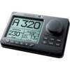
This preloaded, offshore chartplotter combines the power of networking with brilliant color and slim-line design. The GPSMAP 4212 has preloaded BlueChart g2 maps of the U.S. coast and displays them on a whopping 12.1" XGA display with crisp, video-quality resolution. By connecting to the Garmin Marine Network, you can add sonar, radar and weather. The 4212 features highly-detailed BlueChart g2 marine cartography of the coastal United States, including Alaska, Hawaii and the Bahamas. This data provides detailed coastlines, shaded depth contours, navaids, port plans, wrecks, restricted areas and tide and current information. For other areas, the 4212 has a worldwide basemap with high-quality satellite images in place of more traditional maps. With the SD card slot, you can add additional maps without having to connect to a computer. The 4212's high-speed processor draws maps quickly, and its simple intuitive interface makes navigating easy. To keep tabs on your engine room or other area of your boat, you can also connect a live video feed with the 4212's video input and output options. The 4212 connects easily to the high-speed Garmin Marine Network, so you can interface with additional MFDs and add remote sensors. Once connected, you can share information between the 4212 and other chartplotters on your boat. You can also add high-powered radar, sonar and XM satellite weather and radio to your system. This product is bundled with GPS 17 with pole mount adapter. « less
Product Specification
-
General
Product Type: ChartplotterRecommended Use: MarinePreloaded Maps: USACard Reader: SD Memory CardInterface: NMEA 0183, NMEA 2000Included Software: Garmin Worldwide Marine BasemapCompatible Software: MapSource BlueChart g2, BlueChart g2 VisionSBAS: WAASAntenna: ExternalFeatures: 2D / 3D map perspectiveFirst Seen On Google Shopping: February 2007 -
Display
Type: TFT - colorDiagonal Size: 12.1"Width: 9.7 inHeight: 7.2 inResolution: 1024 x 768 -
Navigation
Waypoints: 1500Tracks: 20Tracklog Points: 10000Routes: 20Trip Computer: Sunrise/sunset times, sun/moon positions -
Connections
Interfaces: Garmin Marine Network -
Miscellaneous
Protection: WaterproofWaterproof Standard: IPX7Included Accessories: Protective cover, PC cable, mounting bracket, power cable -
Dimensions & Weight
Width: 14.8 inDepth: 4.6 inHeight: 9.5 inWeight: 9.9 lbs -
Universal Product Identifiers
Part Numbers: 010-00592-01, 4212GTIN: 00753759066062
Related Products
-
SP110VF-4 SP-110 System w/Virtual Feedback & Type T Mechanical
-
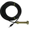
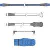
000-167-638 30m Cable
-
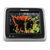
T70106 e7D 7" Multifunction Display w/Sonar, Internal G
-
Marine ILIM40501 Sydney LED Reading Chart Marine Light
-
A65 Mfd USA Charts
-
TS200-30 Temperature Probe f/SST-110 Thru-Hull
-
22096366 - Control Head for AP28
-
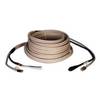
A06035 - SeaTalk NG Backbone Cable 3M
-
LED Navigation Lights, Single Port Vessel Size 165 Each
-
10gb Fiber Optic Cable, LC/LC, Multi Mode, Duplex - 3 Meter
-
03348810 FITTING-FUEL Suzuki 3/8in to 75HP
-
Trolling Motor CONNECTOR, Male, Motor Side #7647-7