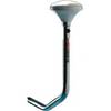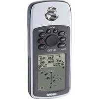
GPS 76 - Marine, hiking GPS receiver - Monochrome - 240 x 180
Model: 240 Brand: Garmin
The GPS 76 is designed to provide precise GPS positioning using correction data obtained from the Wide Area Augmentation System (WAAS). This unit features a built-in quad helix antenna for superior reception and can provide position accuracy to less than three meters when receiving WAAS corrections. The GPS 76 provides 1 megabyte of internal user memory to be used for storing downloaded Points of Interest data. This 1 megabyte of storage area is preloaded from the factory with worldwide cities (populations greater than 200,000) and nautical navigation aids such as lights, buoys, sound signals and day beacons, and is perfect for downloading points of interest detail from Garmin's line of MapSource CD-ROMs. An extra-large display measuring 1.6"W x 2.2"H gives users a clear view of information, while a waterproof case means the GPS 76 will keep working well even if it's been submerged in water. Even more amazing, this unit will actually float if accidentally dropped in the water. « less
Product Specification
-
General
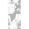
Product Type: GPS receiverRecommended Use: Marine, hikingPreloaded Maps: North America, South AmericaReceiver: 12 channelInterface: Serial, NMEA 0183, RTCM SC-104 DGPSIncluded Software: Garmin Marine Point Database (Americas)Compatible Software: MapSource Points of InterestGrids: UTM, MGRS, Lat/Lon, UPS, Loran TDs, MaidenheadSBAS: WAASDGPS: DGPS readyAntenna: Built-inAccuracy: Position - 49 ft Position - 10 ft - 16 ft ( with DGPS ) Position - 10 ft ( with WAAS ) Velocity - 0.16 ft/secUpdate Rate: 1/secondInternal Memory: 1 MB flashFirst Seen On Google Shopping: November 2001 -
Display
Type: LCD - monochromeResolution: 240 x 180Display Illumination: Yes -
Acquisition Times
Warm: 15 secCold: 45 sec -
Navigation
Waypoints: 500Tracklog Points: 2048Routes: 50Waypoints per route: 50Trip Computer: TracBack -
Battery
Type: AA typeRequired Qty: 2Run Time (Up To): 16 hours -
Miscellaneous
Protection: WaterproofWaterproof Standard: IPX7Localization: English -
Dimensions & Weight
Width: 2.7 inDepth: 1.2 inHeight: 6.2 inWeight: 16 oz -
Manufacturer Warranty
Service & Support: 1 year warranty -
Environmental Parameters
Min Operating Temperature: 5 °FMax Operating Temperature: 158 °F -
Universal Product Identifiers
Part Numbers: 010-00244-00, 76GTIN: 00753759029456, 00753759051648
Related Products
-
SC111 PowerTower Starboard Mounted Bar for Light, GPS, VHF
-
Max EN-M405 W27 Greenland Coasts-MAX
-
St. Lucie Inlet to Lake Pontchartrain: NT+ Wide Coverage by C-Map
-
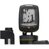
Fishin' Buddy 110 - Fishfinder - included transducer - single-beam
-
010-C0773-20 Bluechart G2 HXEU015RAegean Sea & Sea of Marmara
-
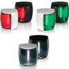
Marine Naviled Pro Port Navigation Light
-
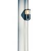
Classic Navigation Light, Streaming/Foredeck Combo
-
743 HPDB50 M/CN50 M SCSI Cable , 25pr - 1.5ft
-
1614g 38 100 Pcs Ring Heat Shrink Connector Blue
-
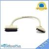
DA62V 3' Cell Adapter Cable
-
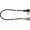
B117-DT-HB 600W Thru Hull Transducer Humminbird #9 Connector
-
5ft 24AWG Cat6 550mhz UTP Ethernet Bare Copper Network Cable - Green