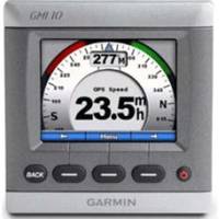
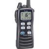
GMI 10 3.5 Inch NMEA 2000 Compatible Marine Instrument 010-00687-00 c31909
Model: c31909 Brand: Garmin
The GWS 10 wind sensor gives you, the sailer, even more control by allowing you to maximise the performance and speed of your boat with wind vane technology. Discover the Benefit of Harnessed Wind Power GWS 10 uses a wind vane for detection of wind direction and an anemometer to register wind speed. These measurements enhance your boats potential as you adjust your sail accordingly to harness the winds strength. Besides delivering wind measurements, GWS 10 captures barometric pressure and air temperature data. When combined with other sensors, GWS 10 enables those on board to gather specific wind data such as ground and true wind, wind VMG and track heading. Enjoy Simple Interface and NMEA 2000 Connectivity Combining wind and weather measurement from a single, integrated sensing unit, GWS 10 installs with ease providing data output to your cockpit display via NMEA 2000 cable and bus, which powers the unit. GWS 10 is designed to interface with Garmins GMI 10 universal marine instrument, the 4000 and marine touchscreen 5000 chartplotter series or any manufacturers NMEA 2000-enabled chartplotters and displays. Garmin GWS 10: Harnessing wind power in a complete mini weather station. A Sep 2008 190-01016-01 Download Technical Reference for Garmin NMEA 2000 Products Rev. C Jul 2010 190-00891-00 Download Training Videos Instruments Master the features of your Garmin Marine Network, then hit the water. These training videos provide expert help for building and customizing your Garmin Marine Network. GMI 10 Get simple, step-by-step instructions on how to build an NMEA 2000 network. Learn how to hook up multiple marine sensors to the GMI 10. « less
Product Specification
-
Universal Product Identifiers
Part Number: c31909
Related Products
-
Type 2 Linear Drive 12V M81131
-
010-00883-00 GPSMAP 740S Radar Pack w/GMR 18 HD
-
300 Series 141c - Fishfinder - included transducer : XNT-9-20-T - single-beam
-
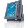
FR8252 Color 12.1 Inch LCD 25 KW 96Nm Radar without Antenna
-
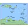
MapSource BlueChart - Southeast Caribbean - Maps
-
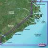
BlueChart g2 Vision - Norfolk-Charleston - Maps
-
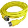
50 Amp 50' Cord Set - Yellow - 125/250V
-
250ft 14AWG CL2 Rated 4-Conductor Loud Speaker Cable (for
-
2104 PowerBar 600 Ampere Cable Connector 4 x 3 8 16 Stud ter
-
3010 Thru Hull Underwater Light - Super White
-
lian B3-I2DN I2 System Dish Network All-in-One Package w/Multi-Sa
-
ic-m7201 M72, 6/3/1 Watt, 15 Hr. Batt, Floats
