Fish-N-Map 8263; Map-Lake Shasta
Model: 8263 Brand:
FISH-N-MAP UNDERWATER TOPOGRAPHY MAPSMade of waterproof, tear resistant plastic. Features include: underwater depth contours, fish locations, latitude and longitude for GPS, multiple freshwater lakes on one map, boat ramps, recreational facilities and much more.
Product Specification
-
Universal Product Identifiers
Part Numbers: 234990, 8263, MSI431890GTIN: 00761428082633
Related Products
-
NX45 12.1" Display W/built-in Sounder & GPS Antenna AA010018
-
E97 Multifunction 9" Display with Sonar - aus, NZ, S. America, Asia Charts T70045 c44345
-
010-00484-04 - 6' Open Array for XHD Pedestal
-
Package(C120W, RA1048D 4KW 48 Inch HD Digital Open Array Radar & 15m Radar Cable)
-
010-C0796-10 Bluechart G2 HEU452SAdriatic Sea North Coast
-
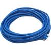
30ft 24AWG Cat5e 350MHz UTP Bare Copper Ethernet Network Cable - Blue
-
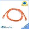
5ft 24AWG Cat5e 350MHz UTP Bare Copper Ethernet Network Cable - Orange
-
407870-1 Ice 345C
-
010-11418-00 - 10M Marine Heading Sensor Cable NMEA0183
-
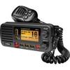
um415 Oceanus D Marine Radio (Black)
-
MMC-00821 Small Water Tight Connector
-
FCF000117A Teak Fresh Air Vent Kit for 5,000 / 9,000 BTU Units