Chart No. 1 Nautical Chart Symbols Abbreviations and Terms [Book]
Chart No. 1 contains a description of the symbols, abbreviations and terms that appear on nautical charts produced by the National Imagery and Mapping Agency, the National Ocean Service and the International Hydrographic Organization.
Product Specification
-
Authors: Griffes, NIMAFormat: paperbackPublication Date: January 1, 2000Key Terms: Plane of Reference, Sector lights, Traffic separation scheme, chart datum, buoy, nautical miles, Racon, Anchorage, Degaussing, nautical charts, World Geodetic System, Fish haven, WHlS, Ash Volcanic, Dot Lt, Supplementary national symbols, Cable Ferry, Loran-C, Submarine power cable, Topmark
-
Universal Product Identifiers
ISBN: 1577852753GTIN: 09781577852759
Related Products
-
AP5011 Autopilot with AP50, J50, Rudder Feedback RF300, HLD2000L (Long Stroke)
-
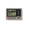
Commander P2 Mono Display, SSRC1 Rate Gyro Compass & Rotary Feedback 10110031
-
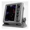
T-940-3 8.4 Inch LCD Display 4KW 48NM Radar with 3.5' Open Array and 10 Meter Cable 33602
-
The Boaters Guide to Using Marine Radar [DVD]
-
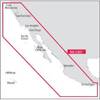
NA-C601 Acapulco, Mexico to Cape Flattery
-
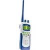
Atlantis 250- Handheld VHF 2-Way Marine Radio
-
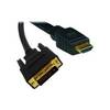
Video cable - Male 19 pin HDMI Type A to M 18 pin digital DVI (Single-Link)
-
Cat6a Ethernet Cable | 3ft | White | Network | 10 Gigabit
-
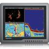
G150 Marine Display 15 Inch E62248 c31586
-
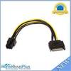
8inch SATA 15pin to 6pin PCI Express Card Power Cable
-
Marine 9-44003: Marine Hose Connectors
-
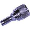
80405 Fuel Connector