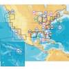
BlueChart g2 Vision - Wrangell to Dixon Entrance - Maps
Model: Brand: Garmin
BlueChart g2 Vision offers the same rich detailed charting of BlueChart g2 to help you get the most out of your unit. In addition, g2 Vision features a growing database of high-resolution satellite imagery, above and below the water 3D perspective, auto guidance technology, aerial photographs for real world reference and coastal roads with points of interest. This product features detailed coverage from Cape Ommaney to Prince Rupert including Prince of Wales Island, Dixon Entrance, Wrangell, AK, Behm Canal, and Observatory Inlet. « less
Product Specification
-
General
Product Type: MapsDistribution Media: SD Memory CardFirst Seen On Google Shopping: May 2007 -
Compatibility Information
Designed For: Garmin GPSMAP 4008, 4012, 420, 4208, 420s, 4212, 430, 430s, 430sx, 430x, 440, 440s, 440sx, 440x, 450, 5008, 5012, 520, 5208, 520s, 5212, 525, 525s, 530, 530s, 535, 535s, 540, 540s, 545, 545s, 550, 550s, 555, 555s -
Universal Product Identifiers
Part Numbers: 010-C0725-00, Wrangell to Dixon EntranceGTIN: 00753759069056
Related Products
-
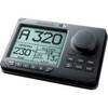
NAVPILOT 720OB Autopilot for Outboard without Pumpset
-
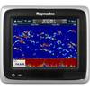
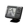
A67 Mfd Touchscreen W/built-in Digital Sonar - Navioni Map
-
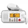
IC-M412 Fixed Mount VHF Marine Radio
-
CF/637P+ NJ & Deleware Plat+ on CF
-
Mark 5x Portable - Fishfinder - included transducer : Skimmer
-
The nautical chart [Book]
-
22096366 - Control Head for AP28
-
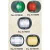
L.E.D., European Style, Navigation, Running Light, Green Starboard, 12V Volts, Black Plastic
-
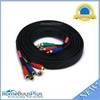
10ft 22AWG 5-rca Component Video/audio Coaxial Cable (RG-59/U) - Black
-
E55051 - SeaTalk hs Network Cable, 10M
-
500 Series 535 Portable - Fishfinder - portable - included transducer - single-beam
-
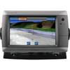
GPSMAP 720 - Marine Chartplotter - 7" color - 800 x 480 - widescreen