BlueChart g2 Vision - St. Lawrence Seaway - Maps
Model: Brand: Garmin
BlueChart g2 Vision offers the same rich detailed charting of BlueChart g2 to help you get the most out of your unit. In addition, g2 Vision features a growing database of high-resolution satellite imagery, above and below the water 3D perspective, auto guidance technology, aerial photographs for real world reference and coastal roads with points of interest. This product features the St. Lawrence River from Brockville, Ont. to Sept-Iles, Que., including Montreal and Quebec. Also includes detailed coverage of Lake Champlain and Lac Saint-Jean, including Burlington, VT, Rideau River, the Ottawa River to Temiscaming, the Riviere Saguenay from Chicoutimi, Que. to the St. Lawrence River, and the Hudson River to Troy, NY. « less
Product Specification
-
General
Product Type: MapsDistribution Media: SD Memory CardFirst Seen On Google Shopping: May 2007 -
Compatibility Information
Designed For: Garmin GPSMAP 4008, 4012, 420, 4208, 420s, 4212, 430, 430s, 430sx, 430x, 440, 440s, 440sx, 440x, 450, 5008, 5012, 520, 5208, 520s, 5212, 525, 525s, 530, 530s, 535, 535s, 540, 540s, 545, 545s, 550, 550s, 555, 555s -
Universal Product Identifiers
Part Numbers: 010-C0721-00, St. Lawrence SeawayGTIN: 00753759069018
Related Products
-
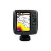
Fishfinder echo 500c - Fishfinder - included transducer - dual-beam
-
010-C0849-10 Bluechart G2 HEU505SBaltic Sea East Coast Data
-
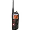
MHS125 Two Way VHF Marine Un MHS125 Mobile Equipmen
-
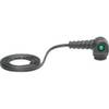
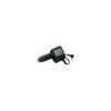
93881 ACR GPS Interface Cable for 2874 Sat 3 EPIRB
-
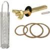
0493DP999M Cork Gasket Kit Sizes 8, 9, 10
-
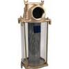
2-1/2" Water Strainer
-
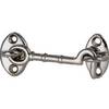
Cabin Door Hook, Bronze, 3-1/2"
-
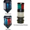
40 Tricolor/Anchor Nav Lite 12/25w
-
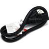
2ft 14AWG Power Cord Cable w/ 3 Conductor PC Power Connector Socket (C13/5-15P) - Black
-
CP-12L Cigarette Light Adapter for M3A/M2A c10195
-
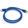
3ft 24AWG Cat6a 500mhz Stp Ethernet Bare Copper Network Cable - Blue
-
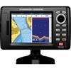
5" GPS CHARTPLOTTER/FF W/MAPS