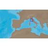
BlueChart g2 Vision - Southeast Florida - Maps
Model: Brand: Garmin
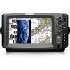
BlueChart g2 Vision offers the same rich detailed charting of BlueChart g2 to help you get the most out of your unit. In addition, g2 Vision features a growing database of high-resolution satellite imagery, above and below the water 3D perspective, auto guidance technology, aerial photographs for real world reference and coastal roads with points of interest. This product features data from explorer charts for the Bahamas! Vero Beach south to include Lake Okeechobee, Florida Keys, Dry Tortugas, and covering the west coast of Florida north to Naples. Also covered all the Bahamas, Andros Island, Eleuthera Island, Cat Island, Great Exuma Island, Little Exuma Island, and Hog Cay. « less
Product Specification
-
General
Product Type: MapsDistribution Media: SD Memory CardFirst Seen On Google Shopping: May 2007 -
Compatibility Information
Designed For: Garmin GPSMAP 4008, 4012, 420, 4208, 420s, 4212, 430, 430s, 430sx, 430x, 440, 440s, 440sx, 440x, 450, 5008, 5012, 520, 5208, 520s, 5212, 525, 525s, 530, 530s, 535, 535s, 540, 540s, 545, 545s, 550, 550s, 555, 555s -
Universal Product Identifiers
Part Numbers: 010-C0711-00, Southeast FloridaGTIN: 00753759068912
Related Products
-
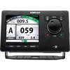
000-10182-001 AP70 Control Unit
-
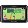
RoadMate 2036 - Automotive GPS receiver - 4.3" color - 480 x 272
-
EM-C950 Furuno FP Format - Marina Di Carrara - Marina Di Tarq
-
WPC087; Throgs Neck to Grenwich CT
-
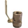
Inline Valve, 1 Inch Pipe
-
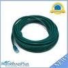
25ft 24AWG Cat6 550mhz UTP Ethernet Bare Copper Network Cable - Green
-
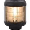
Navigation Light Masthead
-
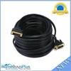
50ft 28AWG DVI-D USB (A Type) to M1-D (pd) Cable - Black
-
CONNECTOR(PAIR) SS 863116
-
HST-WSBL TM Ducer Depth/Temp Blue Connector
-
998c Si Combo Cho Display Only #407760-1CHO
-
1-AR30-10-48 Air 30 Wind Generator 12VDC