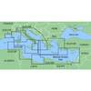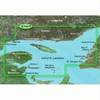
BlueChart g2 Vision - Mid-Atlantic - Maps
Model: Brand: Garmin
BlueChart g2 Vision offers the same rich detailed charting of BlueChart g2 to help you get the most out of your unit. In addition, g2 Vision features a growing database of high-resolution satellite imagery, above and below the water 3D perspective, auto guidance technology, aerial photographs for real world reference and coastal roads with points of interest. This product features coverage of the East Coast from the lower Chesapeake Bay through Jacksonville, FL, to Bermuda. Coverage from Tangier Island to St. Augustine, FL including Norfolk, VA, the Albemarle and Pamlico Sounds in full, Cape Fear, NC, the Savannah R. to Augusta, GA, and the St. Johns R. to Hastings, FL. Bathymetric coverage from Poorman's Canyon to Blake Canyon including Wilmington Valley and Hatteras Ridge. « less
Product Specification
-
General
Product Type: MapsDistribution Media: SD Memory CardFirst Seen On Google Shopping: May 2007 -
Compatibility Information
Designed For: Garmin GPSMAP 4008, 4012, 420, 4208, 420s, 4212, 430, 430s, 430sx, 430x, 440, 440s, 440sx, 440x, 450, 5008, 5012, 520, 5208, 520s, 5212, 525, 525s, 530, 530s, 535, 535s, 540, 540s, 545, 545s, 550, 550s, 555, 555s -
Universal Product Identifiers
Part Numbers: 010-C0741-00, Mid-AtlanticGTIN: 00753759069216, 00828160839472
Related Products
-
PMA10U7L 10quot; Aft Lean Radar Mount F/FURUNO/JRC
-
Memory Map MAR-UKI-11 Memory-Map Marine Chart - UK & Ireland 2011 Edition
-
MapSource BlueChart - Italy, Adriatic Sea - Maps
-
Nautico 3 VHF Marine Emergency Radio Rechargeable
-
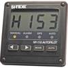
SP110 System w/ rfb & Remote Mech Drive - Sail 12"
-
BlueChart g2 Vision - Les Mechins to St. George's Bay - Maps
-
75ft 24AWG Cat5e 350MHz UTP Bare Copper Ethernet Network Cable - Yellow
-
Cat6a Ethernet Cable | 5ft | Black | Network | 10 Gigabit
-
150AY Y Adapter, 2-15 20 Amp Straight Blade to 30 Amp Locking
-
Flush Mount Utility Light 401515-1 Screw Mount
-
Tone Generator w/ Probe Kit 8134
-
100ft 24AWG Cat6 550mhz UTP Ethernet Bare Copper Network