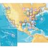
BlueChart g2 Vision - Lake Erie - Lake St. Clair - Maps
Model: Brand: Garmin
BlueChart g2 Vision offers the same rich detailed charting of BlueChart g2 to help you get the most out of your unit. In addition, g2 Vision features a growing database of high-resolution satellite imagery, above and below the water 3D perspective, auto guidance technology, aerial photographs for real world reference and coastal roads with points of interest. This product features coverage of both the U.S. and Canadian sides of the southern portion of Lake Huron. Detailed coverage of the St. Clair River, Lake St. Clair, Detroit River, and the U.S. portion of Lake Erie through Buffalo. Also includes coverage of the Canadian portion of Lake Erie and the western side of Lake Ontario, including detailed coverage of Long Point Bay, Welland Canal, the Niagara River, and Toronto. « less
Product Specification
-
General
Product Type: MapsDistribution Media: SD Memory CardFirst Seen On Google Shopping: May 2007 -
Compatibility Information
Designed For: Garmin GPSMAP 4008, 4012, 420, 4208, 420s, 4212, 430, 430s, 430sx, 430x, 440, 440s, 440sx, 440x, 450, 5008, 5012, 520, 5208, 520s, 5212, 525, 525s, 530, 530s, 535, 535s, 540, 540s, 545, 545s, 550, 550s, 555, 555s -
Universal Product Identifiers
Part Numbers: 010-C0719-00, Lake Erie - Lake St. ClairGTIN: 00753759068998
Related Products
-
TP32 Autopilot Up to 39' w/ HR-22 Remote
-
Nuvi 3450LM Automotive GPS 010-00009-20 c42506
-
Marine ILIM40501 Sydney LED Reading Chart Marine Light
-
CF/637P+ NJ & Deleware Plat+ on CF
-
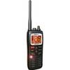
MHS125 Handheld Two-Way VHF Marine Radio
-
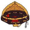
POD-4S 4 Person Life RAFT- Soft Valise
-
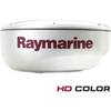
RD418HD 4KW 18" HD Digital Radome (No Cable) E92142
-
12ft RG6 (18AWG) 75OHM, Quad Shield, CL2 Coaxial Cable with F Type Connector - White
-
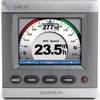
0100068710 GMI 10 3.5" NMEA 2000 Compatible Marine Instrument
-
1- Light Bar for 24" SatDomes - Requires Ltb Top, LTB-S24
-
7ft 24AWG Cat6 550mhz UTP Ethernet Bare Copper Network Cable - White
-
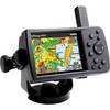
GPSMAP 376C - Marine GPS receiver - 3.8" color - 480 x 320