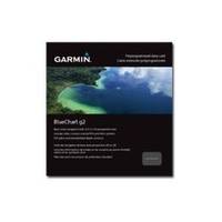
BlueChart g2 - The Netherlands (HEU018R) - Maps
Model: HEU018R Brand: Garmin
BlueChart g2 features crisp labeling and an overall smoother presentation on your chartplotter display. In addition to the basic charts, tidal stations, currents, depth contours, IALA symbols and included fishing charts, BlueChart g2 offers improved transitioning between zoom levels and more seamless continuity across chart boundaries. BlueChart g2 also adds safety shading which allows the user to enable contour shading for all depth contours shallower than the user-defined safe depth. The fishing charts are designed to emphasize bathymetric contours with less visual clutter on the display. « less
Product Specification
-
General
Product Type: MapsDistribution Media: microSD Memory CardBundled with: SD Card adapterFirst Seen On Google Shopping: December 2010 -
Universal Product Identifiers
Part Numbers: 010-C0775-20, The Netherlands (HEU018R)GTIN: 00753759091743
Related Products
-
SP-70MS Autopilot for Cable Steer Straight Helms st70ms
-
SP110VF-7 SP-110 System w/Virtual Feedback & Mechanical Remote
-
CH250BB/88/325 88 kHz Black Box Searchlight Sonar System. Includes 250mm Travel Hoist and Operates at 24 & 32VDC
-
Marine ILIM40501 Sydney LED Reading Chart Marine Light
-
Max Lakes South NA-M019 c30549
-
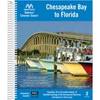
Embassy Cruising Guides - Chesapeake Bay to Florida #BKCBF-02
-
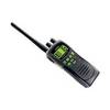
ATLANTIS 250 VHF Two-way radio
-
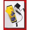
1067 Replacement Nicad Battery for 2726 and 2727
-
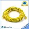
50ft 24AWG Cat6 550mhz UTP Ethernet Bare Copper Network Cable - Yellow
-
VGA Male to Male Cable 50 ft. CL2
-
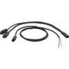
Ashhgps Matrix HH Connect Kit by Humminbird
-
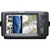
407760-1 Fish Finder, 998 Si Combo