Articles on Hydrography, Including: International Hydrographic Organization, Limnology, Hydrographic Survey, Nautical Chart, Hydrographic Office, Bathymetric Chart, Territorial Waters, Canadian Hydrographic Service, Exclusive Economic Zone [Book]
Please note that the content of this book primarily consists of articles available from Wikipedia or other free sources online. Hephaestus Books represents a new publishing paradigm, allowing disparate content sources to be curated into cohesive, relevant, and informative books. To date, this content has been curated from Wikipedia articles and images under Creative Commons licensing, although as Hephaestus Books continues to increase in scope and dimension, more licensed and public domain content is being added. We believe books such as this represent a new and exciting lexicon in the sharing of human knowledge. This particular book is a collaboration focused on Hydrography.More info: Hydrography focuses on the measurement of the depth and physical characteristics of waters and marginal land. Hydrography generally refers to the measurement and description of any waters, and specifically refers to those measurements and descriptions of navigable waters necessary for safe navigation of vessels. Oceanography and limnology are subsets of hydrography. « less
Product Specification
-
Authors: Hephaestus BooksPages: 168Format: paperbackPublication Date: August 30, 2011
-
Universal Product Identifiers
ISBN: 1243152788GTIN: 09781243152787
Related Products
-
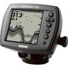
Fishfinder 250 - Fishfinder - included transducer
-
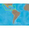
30131 Max - Central America and The Caribbean - C-Card
-
20ft 24AWG Cat5e 350MHz UTP Bare Copper Ethernet Network Cable - White
-
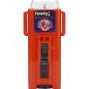
3995.4 Firefly 3 Strobe Same as 3995.3 But Bulk PK
-
25ft 24AWG Cat6 550mhz UTP Ethernet Bare Copper Network Cable - Gray
-
10gb Fiber Optic Cable, LC/SC, Multi Mode, Duplex - 3 Meter
-
1.5ft Premier Series XLR Male to RCA Male 16AWG Cable (Gold
-
USB extension cable - 9 pin USB Type A - M - 9 pin USB Type A - F - 10 ft - PC
-
AISnet Network
-
900 Series 957c Combo NVB - Marine Chartplotter - 8" color - 800 x 480 - widescreen
-
E02035 G-Series Marine Displays, G150 15in Ultra Bright Marine Disply Ray
-
Colormax Wide Internal Wide 7 Inch Panoramic LCD with Internal

