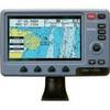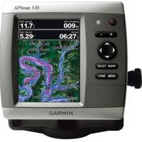
0100077300 Gpsmap536 Plotter
Model: Gpsmap536 Brand: Garmin
Mfr: Garmin - 100077300; These compact GPS/Chartplotters feature an ultra-bright 5" diagonal color display with a high-speed digital design for faster map drawing and panning speeds. Includes a built-in basemap and an easy-to-use interface to help navigate your waters with ease. Accepts BlueChart g2 Vision cards for added features and functionality like high-resolution satellite imagery, 3-D views, and Auto Guidance Technology. 10-32V DC. Other features include AIS support, DSC position display, audible alarms, tide tables, sun & moon informations, NMEA interface, and more. Standard models are GPS/Chartplotters and do not include fishfinding capabilities. Inland Lake maps. 546/546s include the basemap plus U.S. Coastal maps, including Alaska & Hawaii, as well as detailed Bahamas charts. Transducers for S models sold separately. « less
Product Specification
-
Universal Product Identifiers
Part Number: 100077300
Related Products
-
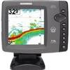
Colormax Wide 7" LCD Colormax Wide External CW15873
-
Package(c97 with aus, NZ, S. America, Asia Chart, 4KW 18 Inch Digital Radome & Radar Cable)
-
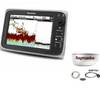
700 Series 778c - Fishfinder - included transducer : XNT-9-20-T - dual-beam
-
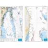
Waterproof Charts 123F Coastal Miami Trolling Chart - FISH/DIVE
-
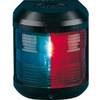
Navigation Light for Bulk Head Mounting Bi Color
-
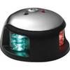
3520-7 LED Red Green, Deck Mount Navigation Light
-
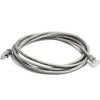
7ft 24AWG Cat5e 350MHz UTP Bare Copper Ethernet Network Cable - Gray
-
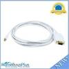
10ft 32AWG Mini DisplayPort | Thunderbolt to VGA Cable - White
-
Anderson Marine Adapter 7-Pole Round to AND-V5416
-
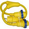
LTD A3030Y30 30 Amp to 30 Amp Y-Adapter
-
Marine Products Plug Wire Set 9-28041
-
Light Bar with Perko 1197 Anchor Light LTB100 (LTB-R + LTBP-1197)