010-C0762-10 Bluechart G2 HEU003RGreat Britain Northeast
Model: 010-C0762-10 Brand: Garmin
Covers from the Isle of Lewis, Scotland to Bridlington Harbour, England, including Gairloch, the Shetland Islands, Edinburgh, and North Sea offshore charts. Also includes the Caledonian Canal, Loch Linnhe, and Loch Ness. See your surroundings more clearly with BlueChart g2 data. With BlueChart g2, you'll get detailed marine cartography that provides convenient viewing of nautical content. BlueChart g2 allows you to see your vessel's precise, on-chart position in relation to naviads, coastal features, anchorages, obstructions, waterways, restricted areas and more. You will also have access to detailed mapping capabilities that include Safety Shading , Fishing Charts , smooth data transition between zoom levels, harmonious transition across chart borders, and reduction of chart discontinuities. « less
Product Specification
-
Universal Product Identifiers
Part Numbers: 010-C0762-10, 10804805, 35597GTIN: 00753759091477
Related Products
-
Video Sboatu3dvd DVD Boaters Guide to Mayday
-
CH250BB/150/225 150 kHz Black Box Searchlight Sonar System. Includes 250mm Travel Hoist and Operates at 12VDC
-
Package(C120W, RA1072HD 4KW 72 Inch HD Digital Open Array Radar & 15m Radar Cable)
-
EFLH2009R MD520N LED Navigation Light Set
-
K1202367 Safelink Automatic EPIRB w/GPS - Category 1 w/Housing
-
701S-00616 ARH100 Automatic Hydostatic Release Housing
-
Marine navigation instruments [Book]
-
50ft HDMI Cable v1.4 Male-to-Male (Black)
-
Patch cable - CAT 6 - RJ-45 - M - Unshielded twisted pair (UTP) 10 ft - Gray
-
Prod 13841 Molded Line Connector
-
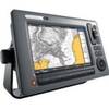
E62111-US - C90Wide 9 MFD, US Charts, Int GPS
-
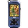
Endura Sierra - Hiking GPS receiver - 2.7" color - 320 x 240