010-C0747-20 Bluechart G2 HXAF001REastern Africa Microsd/sd ADA
Model: 010-C0747-20 Brand: Garmin
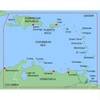
General coverage of the east coast of Africa from the Gulf of Tadjoura to the Bay of Maputo, including Mogadishu, Som., Mombasa, Ken., and Dar es Salaam, Tan. Also includes general coverage of the entire coast of Madagascar. Includes detailed coverage of Djibouti, Dji., Maputo, Moz., Mauritius, Reunion, and the Seychelles. See your surroundings more clearly with BlueChart g2 data. With BlueChart g2, you'll get detailed marine cartography that provides convenient viewing of nautical content. BlueChart g2 allows you to see your vessel's precise, on-chart position in relation to naviads, coastal features, anchorages, obstructions, waterways, restricted areas and more. You will also have access to detailed mapping capabilities that include Safety Shading , Fishing Charts , smooth data transition between zoom levels, harmonious transition across chart borders, and reduction of chart discontinuities. « less
Product Specification
-
Universal Product Identifiers
Part Numbers: 010-C0747-20, 10804540, 35576GTIN: 00753759089641
Related Products
-
North River Type Rowlock Horns *Pr*
-
Showdown 5.6 Digital Fishfinder
-
MapSource BlueChart - Irish Sea - Maps
-
NA-C702 C-Card Format Nanoose - Victoria Cap
-
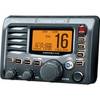
M504 Remote Mic Version - Black
-
MapSource BlueChart - Southeast Caribbean - Maps
-
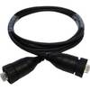
AA010080 - 2m Ethernet (rj45) Cable for NSX Systems
-
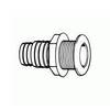
T. H. Marine Conn Thruhul Blk Straight ThruHull Connectors TH1200D
-
B60-12 Tiled Element Ducer W/10P Pigtail Connector
-
HBL26CM13 30A Female Connector
-
Cat6a Ethernet Cable | 50ft | Gray | Network | 10 Gigabit
-
Maptrax GPS402 - Automotive GPS receiver - 4" color - 240 x 320