Asset 1
News
All
Companies
Products
News
Advertise
News
Products
Companies
Home
Nmea 0183, Nmea 2000, Horizontal
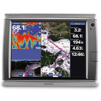
GPSMAP� Touchscreen Chartplotter 7215, preloaded BlueChart� g2 maps of the U.S. coast, 15.5"
1
2
Refine Search
nmea 0183, nmea 2000
(
x
)
•
horizontal
(
x
)
•
(21 of 21)
clear
Category
Chartplotters
(1)
Network Displays
(20)
Brand
Garmin
(21)
Accepts Data Cards
Yes
(21)
Antenna
External
(19)
Internal
(2)
Application
Marine Navigation
(21)
Battery Type
No Battery
(21)
Cartography
US Coastal
(11)
Worldwide Basemap
(8)
US Basemap
(1)
US Inland
(1)
Dimensions
11.5"W x 7.4"H x 5.9"D
(3)
10.1W" x 6.8"H x 4.2"D
(2)
11.2"W x 7.0"H x 4.6"D
(2)
13.0"W x 9.5"H x 4.7"D
(2)
13.3"W x 9.9"H x 5.8"D
(2)
13.4"W x 8.9"H x 4.2"D
(2)
15.5"W x 11.7"H x 5.7"D
(2)
15.5"W x 11.8"H x 5.9"D
(2)
14.8"W x 9.5"H x 4.6"D
(1)
15.0"W x 9.9"H x 5.9"D
(1)
Display Resolution
1024 x 768
(10)
640 x 480
(6)
800 x 600
(3)
320 x 240
(1)
800 x 480
(1)
Interface
NMEA 0183, NMEA 2000
(21)